 |
||
|
|
||
|
Page Title:
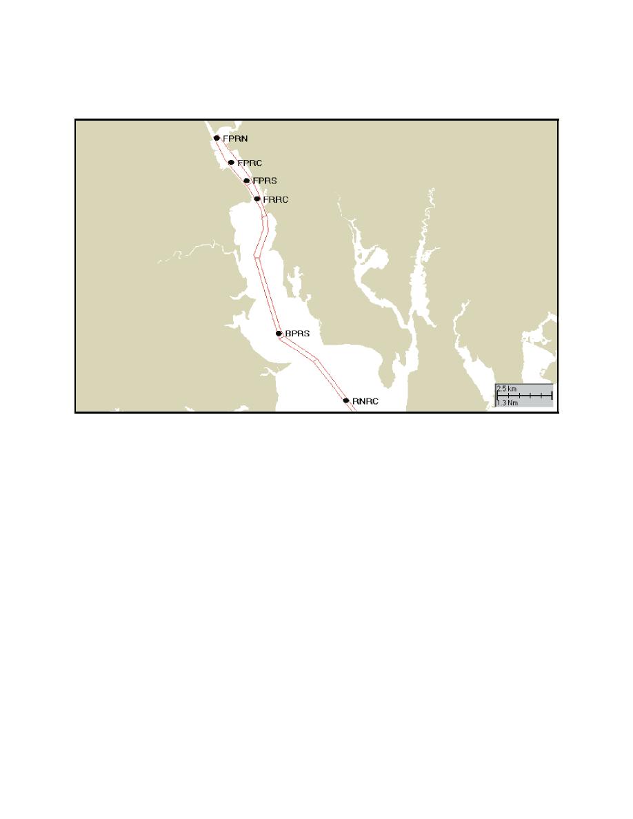
Figure 3. Location of simulated dredging sites in the Providence River and Upper Narrangansett Bay from north to south |
||
| |||||||||||||||
|
|
 ERDC TN-DOER-E12
July 2000
ambient TSS concentrations typically vary from 1.63 to 14.8 mg/L (USAED, New England, 1998).
These can be added to the model predicted concentrations to obtain total concentrations.
Figure 3. Location of simulated dredging sites in the Providence River and Upper Narrangansett Bay from
north to south: Fox Point Reach North (FPRN), Fox Point Reach Central (FPRC), Bullock
Point Reach South (BPRS), and Rumstick Neck Reach Central (RMRC)
The choice of the TSS concentration levels selected for the presentation of model results corresponds
to the ranges presented by Newcombe and Jenson (1996) in a description of their fisheries impacts
model. They analyzed a series of studies of fish response to suspended sediment and developed a
set of empirical equations that relate biological response to duration of exposure and TSS concen-
tration.
The plan view portion of Figure 4 shows the near surface (0-2 m [0-6 ft]) extent of the sediment
plume for the Fox Point Reach Central (FPRC) dredging site with a release rate of 1.5percent,
whereas, the cross-section view presents the TSS concentration over the entire water column. The
lower panel shows the down channel extent of the plume reached during low slack water while the
upper panel shows the up channel extent reached during high slack water. At low slack water, the
plume (at a concentration greater than 20 mg/L) extends approximately 1,000 m (3,300 ft) down
channel of the dredging site. There is some residual material up channel of the site that was
generated during the previous flood tide. At high slack water, the plume extends approximately
780 m (2,550 ft) up channel, with a small amount of material remaining in the water column down
channel of the site. The tidal circulation moves the plume up and down the channel away from the
release site. Thus, any location away from the immediate dredging site experiences elevated
concentrations for only a portion of the tidal cycle.
7
|
|
Privacy Statement - Press Release - Copyright Information. - Contact Us - Support Integrated Publishing |
