 |
||
|
|
||
|
Page Title:
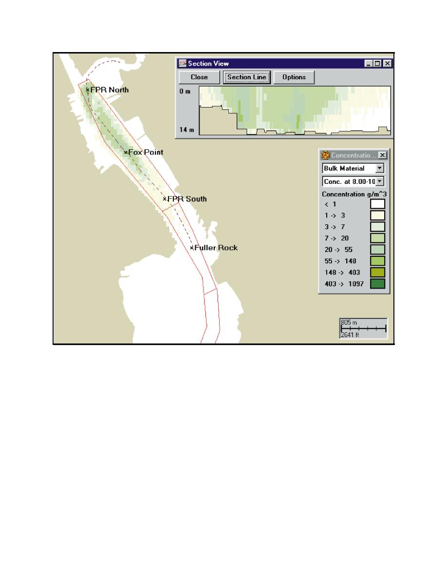
Figure 13. Maximum extent of sediment plume with bucket release rate of 2 percent for Fox Point Reach North (FPRN) and Centra... |
||
| |||||||||||||||
|
|
 ERDC TN-DOER-E12
July 2000
Figure 13. Maximum extent of sediment plume with bucket release rate of 2 percent for Fox Point Reach
North (FPRN) and Central (FPRC) sites over the 3-day simulation time. Plan view shows
release point, channel geometry and maximum concentrations (mg/L) at 8-10 m (26-33 ft)
depth. Vertical section shows distribution of maximum concentrations (mg/L) over depth along
dashed section line shown in plan view. Concentration contours correspond to ranges in the
Newcombe-Jensen (1996) fisheries impact model
locations. Again, the maximum extent of the plumes from each site overlap into each other at
concentration levels around 7 mg/L and the maximum concentrations at both sites occur near the
bottom at a depth of 8-10 m (26-33 ft) with levels in the 55-148 mg/L range. However, the extent
of the maximum concentration plume greater than 3 mg/L at a depth of 9 m (30 ft) is approximately
3.9 km (2.4 mi) for dredging occurring simultaneously at the FPRC and FRRC sites. There are only
two relatively small locations with concentrations greater than 20 mg/L surrounding the release
sites.
Results for the case of simultaneous dredging at three sites (FPRN, FPRC and FRRC) are shown
in Figure 15. The results are similar to the two-release site cases (Figures 13 and 14) except that
17
|
|
Privacy Statement - Press Release - Copyright Information. - Contact Us - Support Integrated Publishing |