 |
||
|
|
||
|
Page Title:
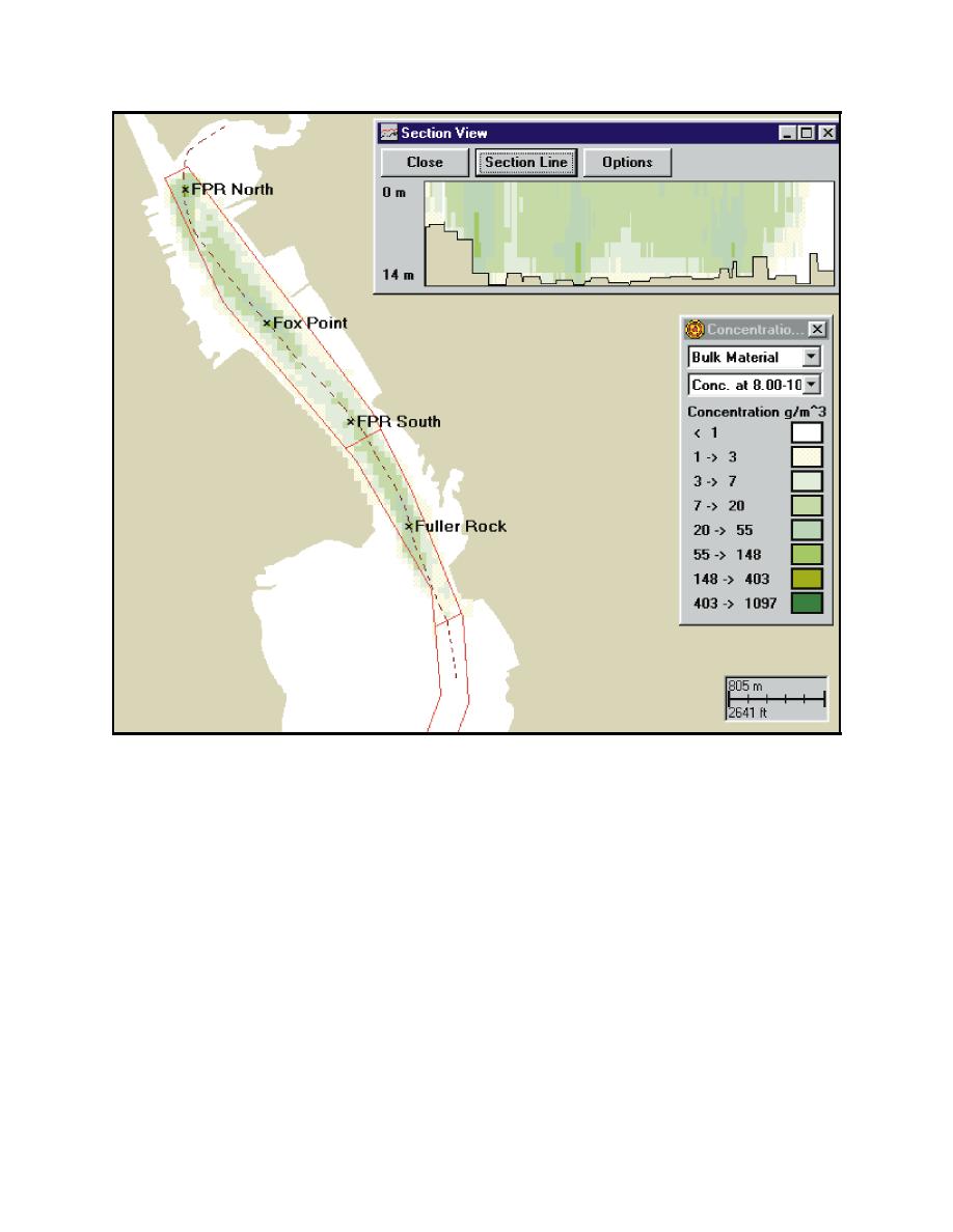
Figure 15. Maximum extent of sediment plume with bucket release rate of 2 percent for Fox Point Reach North (FPRN) and Centra... |
||
| |||||||||||||||
|
|
 ERDC TN-DOER-E12
July 2000
Figure 15. Maximum extent of sediment plume with bucket release rate of 2 percent for Fox Point Reach
North (FPRN) and Central (FPRC) sites and Fuller Rock Reach Central (FRRC) site over the
3-day simulation time. Plan view shows release point, channel geometry and maximum
concentrations (mg/L) at 8-10 m (26-33 ft) depth. Vertical section shows distribution of
maximum concentrations (mg/L) over depth along dashed section line shown in plan view.
Concentration contours correspond to ranges in the Newcombe-Jensen (1996) fisheries impact
model
The dredging sites were selected to be representative of locations along the length of the channel
from the Fox Point Reach to the Rumstick Neck Reach where dredging will occur. The model
simulated the release of material over the water column individually from three separate sites and
then from two and three sites simultaneously. Three release rates of 1.5, 2, and 4 percent of the total
dredged material were used to simulate the effects of different types of buckets and barge filling
protocols. Only a release rate of 2 percent was used in the simulation of dredging plumes created
simultaneously from more than one site.
In general, the resulting TSS concentrations in the water column were highest in the Fox Point Reach
and lower at the southern sites. This was due to the increased availability of diluting water at the
19
|
|
Privacy Statement - Press Release - Copyright Information. - Contact Us - Support Integrated Publishing |