 |
||
|
|
||
|
Page Title:
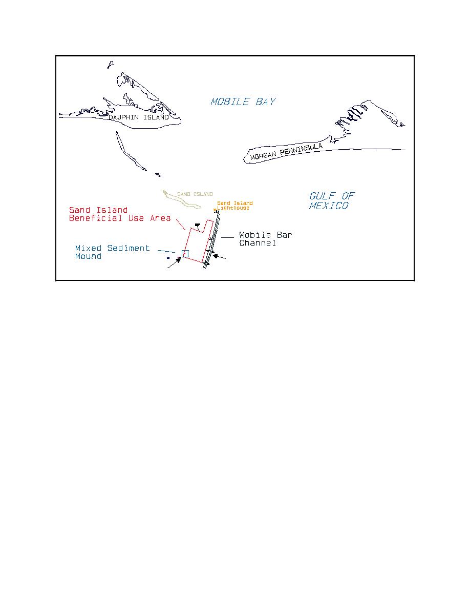
Figure 1. Location of study site offshore of hteentrance to Mobile Bay |
||
| |||||||||||||||
|
|
 ERDC TN-DOER-N6
March 2000
Navigation Channel
P lacement L ocation
Figure 1. Location of study site offshore of hteentrance to Mobile Bay
in a mound outside the entrance to Mobile Bay. The material had a consistency described loosely
as "black mayonnaise." It was removed with a bucket dredge and transported to the placement site
using one 4,590-cu-m (6,600-cu-yd) and two 3,060-cu-m (4,000-cu-yd) split-hull barge scows. The
placement area was located on the southwestern edge of the entrance ebb shoal (Figure 1) in water
depths of between -9 and -10 m (-30 and -33 ft) mean lower low water (mllw). The shallowest
depths on the shoal are north of the placement area, around -4.5 m (-15 ft) mllw. The deepest areas,
up to -15 m (-50 ft) mllw, are to the east in the dredged navigation channel.
Data were collected prior to, during, and periodically following the dredging and placement
operations. Data collection and analyses included sediment characteristics of the material while it
was in the barge and after placement in the mound, sediment characteristics of the surrounding
seabed before and after placement, and periodic bathymetry of the study area, waves, and currents.
Postplacement monitoring at the mound site was planned for 1 to 3 years depending on the changing
characteristics of the mound and available long-term funding for the study.
MONITORING
Bathymetry. On 28 September 1998, just prior to the initiation of the project, the eye of Georges,
a Category 2 hurricane, made landfall in the vicinity of Ocean Springs and Biloxi, MS, 80 to 121 km
(50 to 75 miles) to the west of the study area. The study area was therefore on the more intense
right front quadrant of the storm. The western end of Dauphin Island was overwashed. Storm
surges were reportedly around 2 m (6.7 ft) (Federal Emergency Management Agency (FEMA) 1999)
2
|
|
Privacy Statement - Press Release - Copyright Information. - Contact Us - Support Integrated Publishing |
