 |
||
|
|
||
|
Page Title:
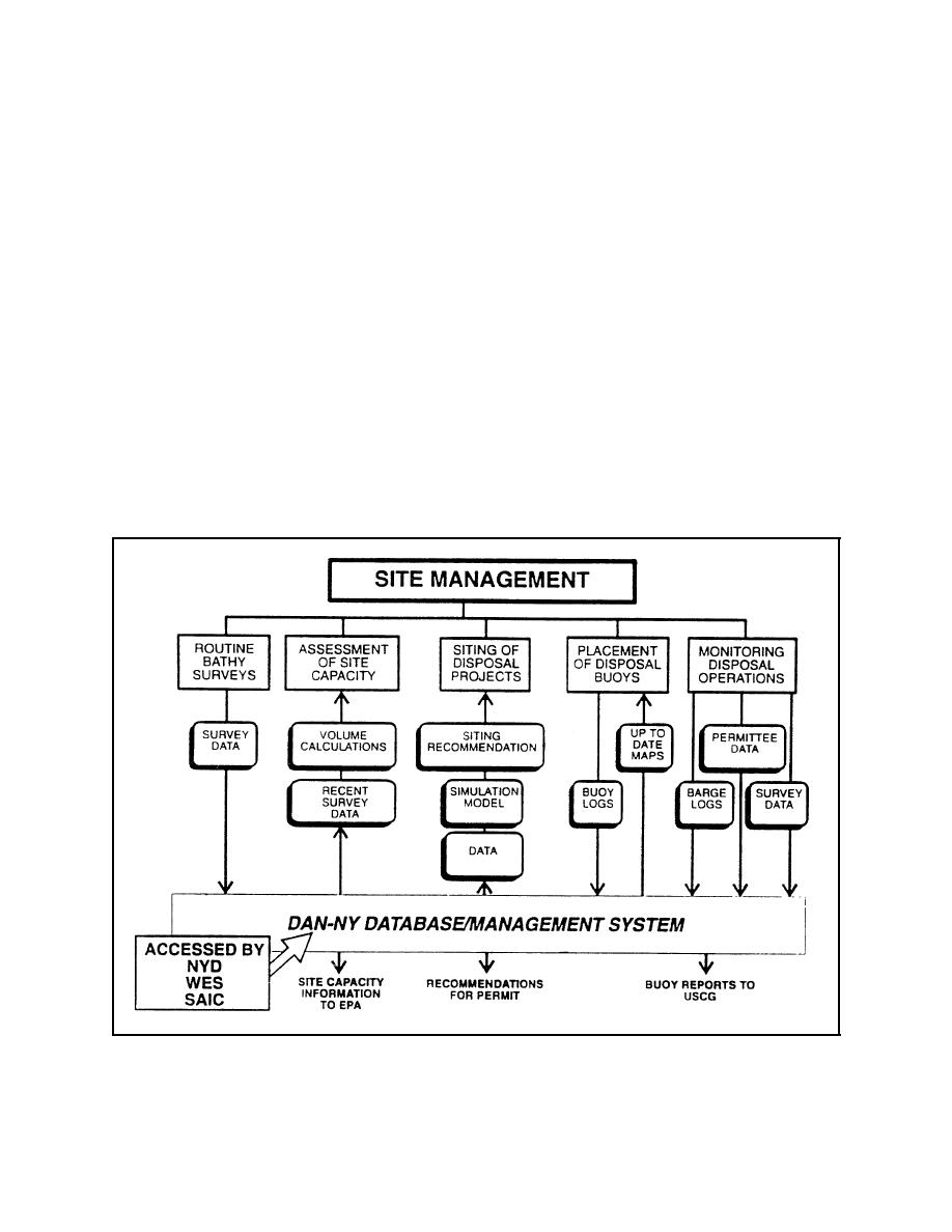
Figure 1. Site management activities supported by DAN-NY |
||
| |||||||||||||||
|
|
 Technical Note DOER-N2
April 1998
DAN-NY functions at two levels. It has quick access to maps and summary information for use by
upper level management or in-depth (extended analysis) capabilities for the technical user. Quick
access features (available by selecting one or two options from the opening menu) allow the user
to view and print any bathymetric surveys in the database along with the more recent barge
placement locations. In the extended capabilities mode, the user has access to an array of tools that
will apply to many day-to-day activities as well as longer term planning and design related studies.
Figure 1 shows the range of tasks that can be done in DAN-NY. In addition to the more obvious
abilities to display bathymetric survey data in a wide range of options, DAN-NY can accomplish
the following:
Compute site capacity.
Predict mound geometry using the Multiple Dump FATE of dredged material (MDFATE)
model developed as part of the Dredging Research Program (DRP) (Moritz and Randall
1995).
Display the mound created and compute volumes.
Associate mounds with buoy locations.
Figure 1. Site management activities supported by DAN-NY
5
|
|
Privacy Statement - Press Release - Copyright Information. - Contact Us - Support Integrated Publishing |